|
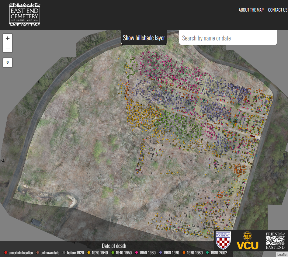
East End Cemetery in Richmond, Virginia, is among the region’s largest and most significant burial grounds (Fig. 1). Founded in 1897 by a private association of leading Black citizens, it would grow to span 16 ac (6.4 ha) and hold an estimated 15,000 burials, given observable burial patterns there. For decades, the cemetery provided one of the most prominent public arenas for memorializing Black lives within the constraints of the Jim Crow system. Families raised fashionable grave markers of all shapes and sizes throughout the site and enclosed their plots with personalized curbing and fencing. Burial activity within this collaborative memorial landscape peaked in the 1960s just as the city desegregated its cemeteries, with only 51 recorded interments in East End Cemetery after 1980 until a final burial in 2002 (Fig. 2). Since its peak, East End and its stewards have faced vandalism, dumping, extensive overgrowth, financial setbacks, and, most importantly, a lack of structural support in comparison with predominantly white cemeteries nearby. To date, only 3,340 grave markers have been found, as many remain lost or have been destroyed. Moreover, no formal interment records survive, and physically navigating the overgrown, uneven grounds is challenging.
In 2017 this core group of regular volunteers created a more formal structure, forming the Friends of East End Cemetery (FOEE), a nonprofit organization. By coordinating hundreds of workdays consisting of thousands of person-hours, FOEE cleared much of the cemetery and uncovered, mapped, and catalogued more than 3,300 grave markers (Palmer 2021). To assist with this important work, FOEE also partnered with the University of Richmond and Virginia Commonwealth University to form a community now called the the Richmond Cemetory Collaboratory. As a member of the Richmond Cemetery Collaboratory, I have worked with Beth Zizzamia to fly drones over East End Cemetery (and other historically black cemeteries across Richmond) to assist in community building, mapping, and outreach. In 2019, Matt Franklin (UR '19) used drone imagery from East End Cemetery and ArcGIS Pro to create a workflow and methodology to count burial site depressions and geo-located about 8,000 sites. The results of this work, co-authored by Beth Zizzamia and Dr. Ryan Smith at VCU, was published in the International Journal of Historical Archaeology in 2022. You can read more about it here. |
|